10 Top Hiking Trails in California
California is a hiker's dream, with such a diverse range of landscapes. The magnificent, glacier-carved valley of Yosemite; a breathtaking, mountainous coastline in Big Sur; the serenely barren Mojave Desert; the majestic, snow-capped Mount Shasta; and a harsh, untamed wilderness in Solstice Canyon are just a few of the natural wonders on offer.
This list of the best hikes in California includes a variety of moderate to tough walks in well-known locations such as Yosemite and Mount Shasta.
1. Yosemite Falls Trail: Hike to North America's Tallest Waterfall for a Spectacular Experience

This walk offers close-up views of Yosemite's most dramatic cascade as well as sweeping vistas of the valley floor, making it one of the top hikes in Yosemite National Park. The route is divided into two sections. The Yosemite Falls Trail is a nine-mile round-trip hike when both portions are combined.
The one-mile segment to Columbia Rock on the Yosemite Falls Track is a strenuous climb that ascends 1,000 feet over a switchback trail. Columbia Rock offers panoramic views of Yosemite Valley and Half Dome in the background. This segment is a two-mile round-trip hike that takes about two to three hours if you do not complete the second half of Yosemite Falls Trails.
Yosemite Falls is only a short distance away on the Yosemite Falls Trail. Hikers typically feel the mist from the waterfalls as they climb the trail. Hikers are astonished by the vast perspectives of the entire Yosemite Valley after reaching the peak of this hard trek.
The greatest time to hike Yosemite Falls Trail is in the spring when the waterfalls are at their most spectacular. The water levels are lower by August, and the falls are less spectacular.
2. Joshua Tree National Park’s Lost Palms Oasis and 49 Palms Trails
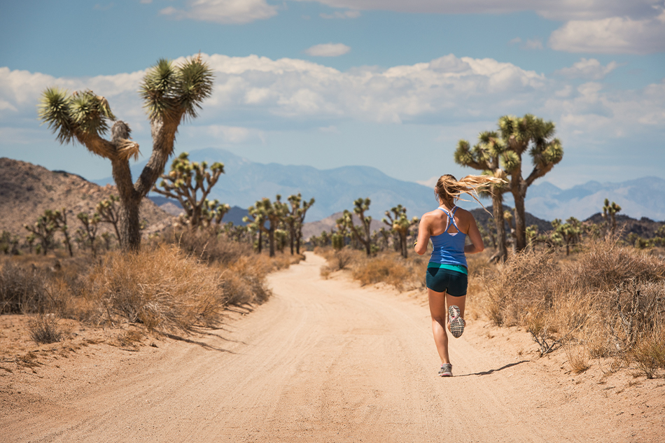
The rough and arid Mojave Desert, a unique section of the California desert region, is home to Joshua National Park. Although the Joshua tree is the park's most famous feature, it also has other interesting paths that wind through palm oases.
The Lost Palms Oasis Trail is a moderate 7.2-mile round-trip climb in a canyon filled with green palm trees and cool pools of water. Cottonwood Campground, which has a picnic area and drinking water, is where the trail finishes.
The 49 Palms Oasis Trail is a three-mile round-trip hike that rewards hikers with springs of pure water sheltered by palm trees. Because this trip contains a 300-foot elevation rise, hikers must be in good physical condition, as the ascent is particularly tough in the desert heat.
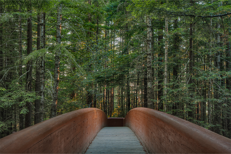
3. Prairie Creek Redwoods State Park’s James Irvine Trail
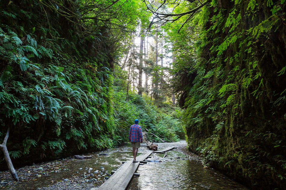
The 10-mile round-trip James Irvine Trail near Prairie Creek is the best hiking in the Redwood National and State Parks. The scenery of Redwoods State Park is varied and magnificent. This moderate walk weaves its way through dense redwood forest, around slopes and hillsides, and through valleys.
The James Irvine Trail links with the short (0.6-mile) Fern Canyon Trail, which leads to the beach, at the trail's finish. The canyon is covered in seven distinct varieties of ferns. The lush foliage absorbs noise, resulting in a sense of serenity. Except for the chirping of birds, the rushing (or trickling) of a freshwater brook, and the distant crashing of ocean waves, it's entirely silent here.
Hollywood directors chose Fern Canyon as a background for scenes in the Jurassic Park film because it is so beautiful. During the Jurassic Period, relatives of today's surviving coastal redwoods existed 160 million years ago.
4. Runyon Canyon Park, Los Angeles
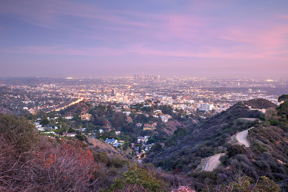
The Runyon Canyon Park is a hidden jewel in the heart of Los Angeles, where inhabitants rarely go for a walk. Only two blocks from Hollywood Boulevard sits the 130-acre park. Most tourists, however, are unaware of its existence. Locals come here to get some exercise and stroll their pets in the fresh air.
Runyon Canyon Park has a variety of routes, all of which give spectacular views of the rough nature and Los Angeles cityscape. The Pacific Ocean and Catalina Island can be seen in the distance from several vantage points. Tourists should also visit Griffith Park in Los Angeles, which has a number of good hiking routes.
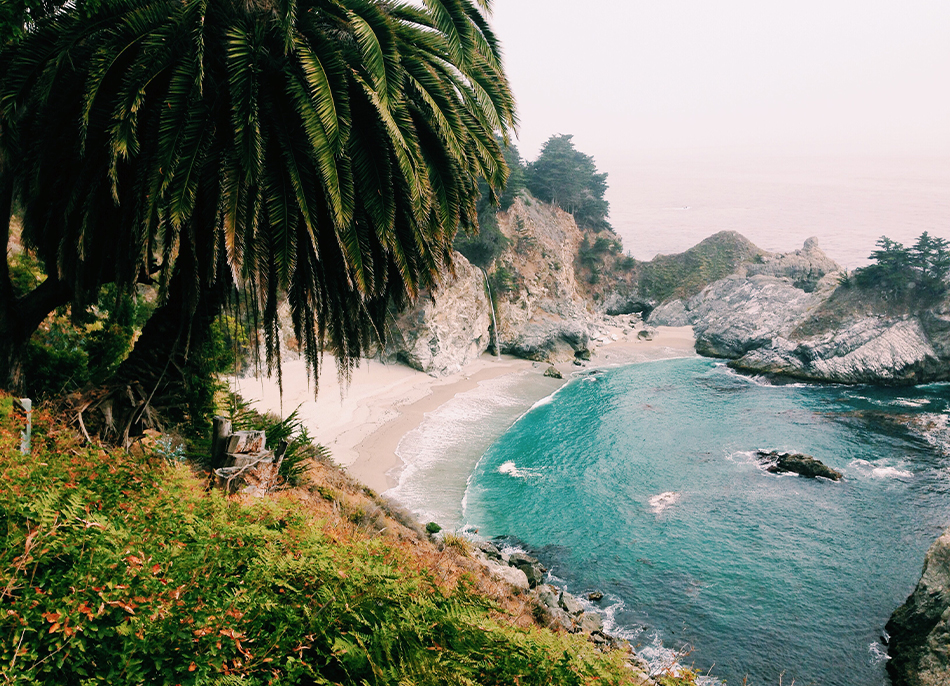
5. McWay Waterfall Trail: The Most Iconic Site in Big Sur
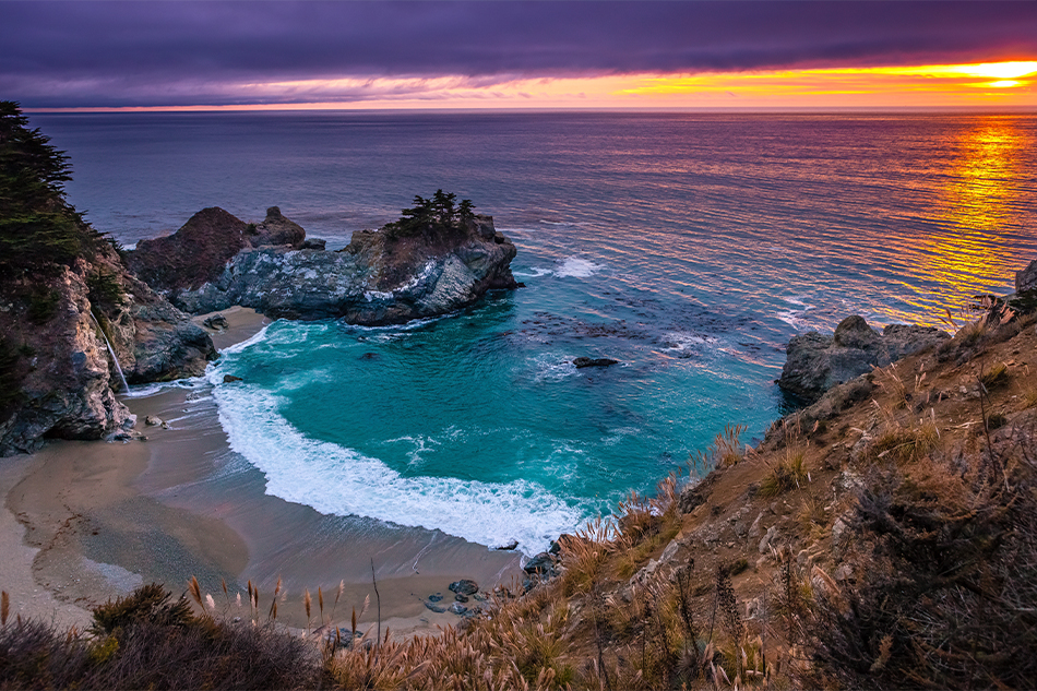
Julia Pfeiffer Burns State Park has a trail that leads to Big Sur's most photographed site. The park spans along the rocky Big Sur coastline, with its forested 3,000-foot slopes that drop off abruptly into the Pacific Ocean, and is named after a female pioneer who had a ranch in the Big Sur region in the early 1900s. Two walk-in campsites at Julia Pfeiffer Burns State Park are among the best in Big Sur.
The McWay Waterfall Trail leads to a lookout point for the McWay Waterfall. This hike is surprisingly easy and short, despite the beauty of the surroundings. The 0.6-mile round-trip track takes around 30 minutes to complete and is more of a stroll than a trek.
The lookout offers a spectacular view of the 80-foot McWay Waterfall, which cascades from a sheer granite cliff into a hidden cove below. Hikers may spend more time appreciating the waterfalls and vistas of the ocean than hiking. During the migration season, the viewpoint is also a wonderful place to see whales.
6. Sea Lion Point Trail in Point Lobos
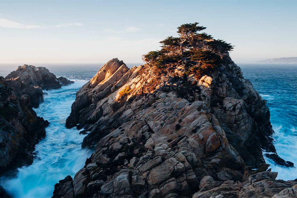
Nature lovers who enjoy marine life and ocean views will enjoy the Sea Lion Point Trail. The 0.6-mile circular trail in Point Lobos State Reserve in Carmel is a short and simple hike that is particularly picturesque. A one-hour drive south of Santa Cruz is the picturesque beach resort of Carmel, which is also known for its beautiful hiking trails.
Hikers can observe barking sea lions on offshore rocks as the Sea Lion Point Trail winds among quiet bays and steep ocean bluffs that meet with roaring surf. Headland Cove and Sea Lion Cove, both calm coves where seals swim and sea otters lounge in the protected waters, are also along the trail.
Hikers can get a closer look at the creatures by walking down a stairway that leads to the coves. If you're descending the steps down to the coves, keep an eye out for sudden waves and stay away from the edges.
7. Solstice Canyon Trail in Malibu
The Solstice Canyon Trail, located near the shore in Malibu and a perfect day trip from Los Angeles, is a location of calm beauty. The trail is located within the Santa Monica Mountains National Recreation Area, which was historically significant to the Chumash people.
The Solstice Canyon Trail is one of Southern California's most popular hiking paths, as well as one of the best sites to see and appreciate nature in the Santa Monica Mountains. This two-mile round-trip journey starts at the parking lot and winds through oak trees and coastal shrubs as it meanders alongside a creek. The walk offers breathtaking views of deep blue Pacific Ocean, steep gorges, and sagebrush-covered mountains.
On weekends, the trail can get crowded due to its proximity to the Malibu beaches. Despite this, the Solstice Canyon Trail maintains a sense of remoteness and provides a tranquil respite from the hustle and bustle of urban life in Southern California.
Poison oak, bees, and rattlesnakes are all dangers to hikers. You avoid being bitten by ticks, make sure to wear the appropriate footwear and clothing.
8. Redwood National Park: Boy Scout Tree Trail
The Jedediah Smith Redwoods State Park, located near the Oregon border in northern California, is one of the Redwood National and State Parks. It’s hiking sections provide tourists a lovely sense of being far removed from the city.
The 5.6-mile round-trip Boy Scout Tree Walk, a moderate trail through an old-growth redwood forest, is one of the best treks in the Redwood National and State Parks. Except for occasional switchback curves and steep hills, the terrain is mostly easy. Allow a half-day to hike the trail and stop to admire the lush canopy of gigantic trees.
Hikers will return to the trailhead via a circle that ends at the beautiful Fern Falls.
9. Pomo Canyon to Shell Beach in Sonoma County
Sonoma County, 75 miles (approximately a two-hour trip) north of San Francisco, has some of California's most beautiful coastal landscapes. The 3.5-mile Pomo Canyon Trail in Sonoma Coast State Park traverses a variety of landscapes and is moderately difficult. The trail ascends through a beautiful redwood forest before continuing over a wooded peak with spectacular views of the Pacific Ocean.
The walk winds its way across meadows dotted with vibrant seasonal wildflowers and crosses several tiny, lovely rivers. The track eventually connects with an old road that leads down to Highway 1 near the finish of the hike.
It's a short walk through the headlands from the highway to the sandy shoreline of Shell Beach. After spending time at the beach, return to the Pomo Canyon trailhead to complete the seven-mile round-trip hike. Hikers could also do the reverse hike, beginning at the Shell Beach parking lot.
The area north of San Francisco (Marin County and Sonoma County) is known for its beautiful natural scenery and wonderful hiking trails. It's worth exploring some of the other fantastic hiking trails near San Francisco.
10. Mount Shasta
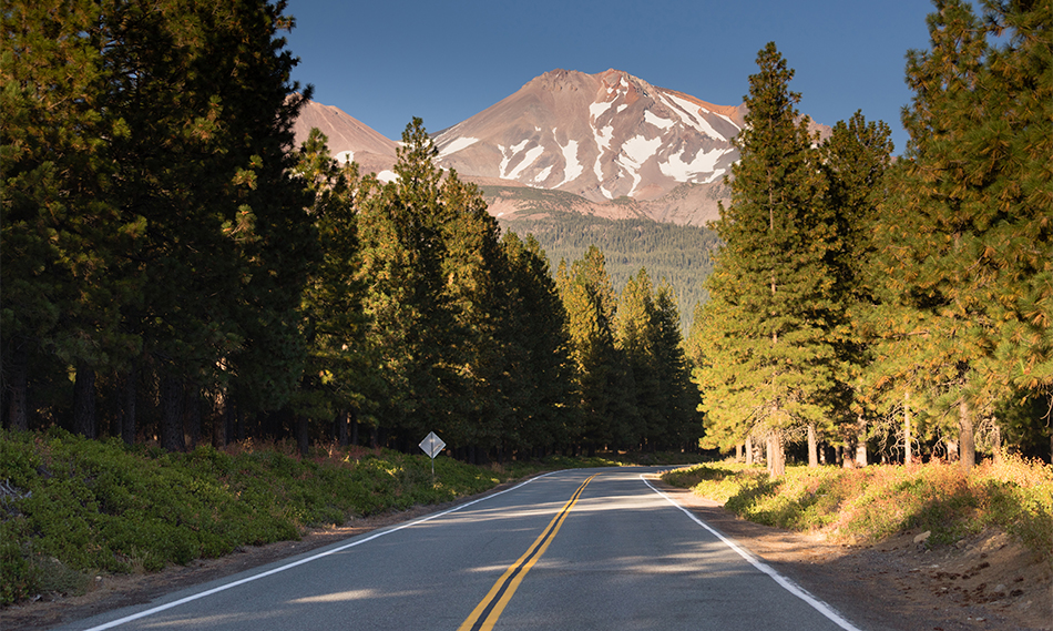
Mount Shasta, with its spectacular snow-capped peak, is one of California's most inspiring hiking destinations. Many people come to Mount Shasta in search of a spiritual encounter in the natural world. Climbing to the pinnacle of the mountain is a challenge for adventurous nature enthusiasts. Mount Shasta, on the other hand, has numerous hiking trails suited for the ordinary hiker.
The Gray Butte Trail is a popular walk on Mount Shasta. This moderate, 3.5-mile round-trip hike adds 750 feet and takes about three hours to finish, with a starting over 7,000 feet in elevation.
The trail starts at the Panther Meadows Campground parking lot, travels across the spacious Lower Panther Meadow, and then ascends through a magnificent forest of old-growth Red Fir trees.
The right-hand side of the trail at the bifurcation ascends through a grove of aromatic Mountain Hemlock trees. The trail continues past the Lower Peak of Gray Butte to the Upper Peak, with spectacular panoramic views from various vantage spots along the way.
This trail is only open during the summer and early fall, from late June to late October.
Plan for the best time to go hiking. In the summer, start your hike early in the day because the trail may get very hot by noon, and the upper stretch of the trail is exposed and without shade by late afternoon.
Hiking Tips: Consider the length of the round-trip trek and the time of sunset in the spring and autumn; be sure to leave early enough to accomplish the round-trip in daylight.
Hiking shoes with good tread are recommended because some trails can be slippery. Bring bottled water; drinking water may be in short supply on some trails.